Career Categories: Computer Assisted

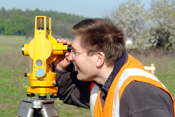
Geodetic Surveyors
 Geodetic surveyors measure the land and water with satellites and other mapping equipment. They use this information to find underground rock and water formations that help architects build on the best land.
ITSISU Activities:
Earthquakes Around the World
Comparing Earthquake Depths and Magnitude Patterns
Investigating Plate Boundaries
Mixing with Water
Links:Comparing Earthquake Depths and Magnitude Patterns
Investigating Plate Boundaries
Mixing with Water

